Flood Level Assessment NSW: How Engineers Determine Flood Risk on Your Site
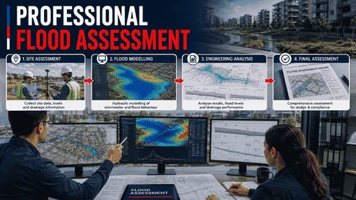
A flood level assessment NSW helps you find out if your development site has a risk of floods, and how this can change your design plans. If your property is close to a creek, a gully, a water channel, or sits in a low area, this assessment shows the real flood levels for your land. It also tells you how these levels can change your works, and what kind of engineering you have to do to fix them. At R I Eng Pty Ltd, we run flood level assessments for houses, townhouses, duplexes, attached dwellings, and granny flats all over New South Wales.
What Does a Flood Level Assessment NSW Actually Cover?
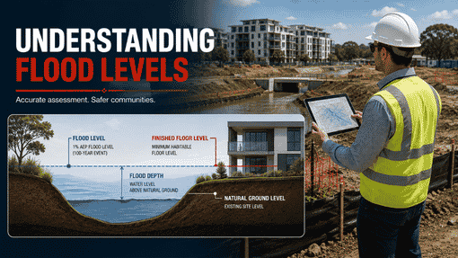
A flood level assessment NSW checks your site using engineering. It shows the flood planning level for your land. The AHD flood level (Australian Height Datum) tells how high flood water can get during a big storm.
From there, the assessment covers:
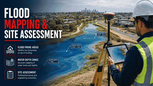
We will do a site flood analysis. In this, we look at the flood maps and survey data. This helps us see how water moves on and around your property when there is a storm.
1 in 100 AEP assessment — the key point is the 1-in-100-year flood event, which has a 1% chance to happen each year. Your site check looks at whether floodwater gets to your land at this level and how deep the water would be.
DEM flood analysis — when we can get it, Digital Elevation Model data helps our engineers see the shape of the land better. This data helps them know how water could flow or spill over in that area, and helps them get better results.
Flood frequency analysis looks at how floods can happen at different times. At some sites, we check how water acts during many types of storms. This helps give you a full idea of risk. You do not just get the worst case. You get the whole story.
The result is a clear report for your site. It tells you what flood levels matter for your project. You will also know what your civil design needs to cover.
Why Houses, Townhouses, and Granny Flats Need This Assessment
Many people who build a new home, add a granny flat, or plan to build two homes on one site are shocked to learn their land is in a flood zone. Over the last ten years, flood maps have covered more places in NSW. A spot that was not in a flood area some years ago may now be in one on the latest council maps.
For a townhouse or an attached home, this is even more important. When there are shared lots with several homes, the floor plan must work well for all the homes. It cannot be made for just one home.
A flood level assessment NSW shows you what rules and risks are at your site before you start working on a design. This helps you not have problems later on. You do not face extra costs from making big changes if the council asks about flood issues after you finish your civil plans.
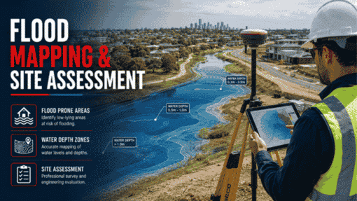
How R I Eng Pty Ltd Conducts Your Flood Level Assessment
Our engineers look at your site address and compare it with the latest council flood maps and the right flood planning level tables. They check AHD survey data for your land and match it with the flood planning level that is used.
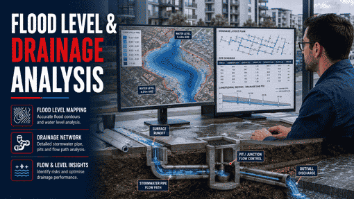
When the assessment needs a water flow check, especially for sites close to rivers or places where council flood studies do not show a clear answer, we use DRAINS software to model the site. This helps us check how floods might happen at the 1 in 100 AEP level.
The finished assessment is an easy-to-read engineering report. It lays out the flood planning level. It tells if your site has been hit by a flood. It also shows what the civil design should do. We make sure to write it so your engineer, builder, or private certifier can use it right away.
5 Quick Answers on Flood Level Assessment NSW
Q: How do I know if my property needs a flood level assessment?
If your property is close to a waterway, or near a line where water flows, or it shows on council maps as a place that gets floods, you should get an assessment. R I Eng Pty Ltd can let you know fast just by using your address.
Q: What is AHD and why does it matter?
AHD means Australian Height Datum. It is the standard used across Australia to measure land and flood heights. When you plan for floods, the level is shown in AHD. Your floor levels should be higher than AHD.
Q: Does a flood level assessment apply to granny flats?
Yes. A granny flat is one that people stay in. If the place has flood risk, the floor of the granny flat has to be at the flood planning level. This is the same as the main house.
Q: What is the 1 in 100 AEP flood level?
The 1 in 100 AEP flood level is the point that has a 1% chance to happen in any year. Engineers often call it the design flood. In NSW, most councils use this as the main guide for their flood planning needs.
Q: How long does a flood level assessment NSW take?
For most homes like houses, townhouses, duplexes, and granny flats, R I Eng Pty Ltd usually gives the assessment in three to five business days after they get your site details and survey data.
Need a flood level check for your NSW site?
R I Eng Pty Ltd does civil engineering flood checks for homes across NSW. You can visit riengineering.com.au to contact us, or call us to talk about your site. We team up with owners, builders, and developers. We help with houses, townhouses, duplexes, attached homes, and granny flats — and we give you results fast.
📞 Call us: +61 0451 452 932
💬 WhatsApp Us: Chat on WhatsApp
📧 Email: riengineering2155@gmail.com
🌐 Visit: riengineering.com.au