Flood Management Plan Wollongong: What Illawarra Developers Need to Know Before They Build
A flood management plan in Wollongong catches a lot of property owners off guard. They look at their site — maybe a block in Fairy Meadow, or a corner lot in Dapto — and assume flooding is not their problem. Then, the council flags the site as flood-affected. The DA stalls. The timeline blows up.
I have seen this happen repeatedly across the Illawarra region. And almost every time, it comes down to one thing: the owner did not know their site was in a flood planning area until the application was already lodged.
So here is what you actually need to know — before you get to that point.

Why Wollongong’s Flood Risk Is Different from Anywhere Else in NSW
Wollongong sits in a geography that creates flood problems unlike almost anywhere else in the state. The Illawarra Escarpment rises sharply behind the city. The coastal plain between the escarpment and the ocean is narrow and flat. And the natural drainage outlets — creeks running west to east across that plain — are limited in number and capacity.
When heavy rain hits the escarpment, it does not spread across a wide catchment. It concentrates. It accelerates down steep gullies and hits the flat coastal plain fast. Streets flood before drains can cope.
The escarpment also creates its own weather. Moist easterly air rises over the ridge and drops intense, localised rainfall — sometimes over a very small area. This orographic rainfall effect means Wollongong gets rain intensity figures that are significantly higher than most of Sydney. Engineers who use Sydney rainfall data for Wollongong projects will undersize drainage systems. We use Wollongong-specific Bureau of Meteorology data in every flood assessment. That distinction matters more than most clients realise.

What a Flood Management Plan Wollongong Actually Covers
Here is what the assessment covers:
Flood hazard level for your site. Not all flood-affected land carries the same risk. Some sites sit at the edge of the flood planning area and face low-hazard conditions. Others are in medium or high-hazard zones where more detailed civil design work is needed. We identify the correct hazard category from Wollongong City Council’s flood mapping.
Required floor and ground levels. The flood management plan for Wollongong specifies the minimum floor levels for habitable areas and the minimum finished ground levels for the site based on the flood planning level. These figures come directly from the council’s mapping and the relevant design storm events.
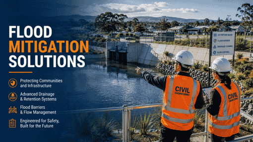
Flood-compatible civil construction. For sites in flood planning areas, certain construction methods and materials are required below the flood planning level. Our report specifies what applies to your project based on the hazard category.
Overland flow path management. Rain does not always travel where pipes expect it to. Overland flow paths — the routes water takes across the surface during major storm events — need to stay clear and functional. Our civil design work identifies these paths and makes sure your development does not block them.
Impact on the surrounding catchment. Council needs to know that your development will not make things worse for your neighbours. Our assessment addresses this directly using hydraulic analysis.
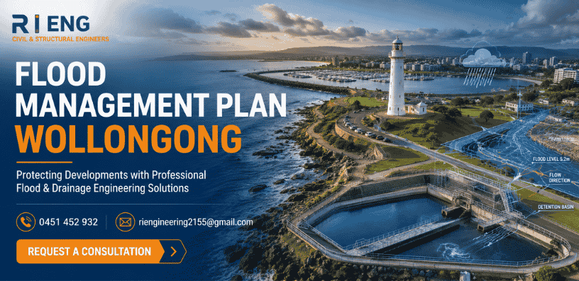
Tidal and coastal interaction. For sites near Lake Illawarra, Towradgi Creek, or the coastline, we also assess how tidal levels and coastal conditions interact with rainfall flooding. During an East Coast low event, both can occur simultaneously. That combined scenario needs to be part of the design basis.
Which Parts of Wollongong Are Most Commonly Flood-Affected?
The flood planning areas in Wollongong are not random. They follow a predictable pattern based on the region’s geography.
Lake Illawarra corridor — Warrawong, Primbee, Windang, and Berkeley sit low and close to the lake. These suburbs carry consistent flood risk and regularly appear in council flood mapping.
Mullet Creek catchment — Dapto, Kanahooka, and Brownsville lie in the Mullet Creek flood corridor. Flooding here can be significant during major rainfall events.
Coastal creek corridors — Fairy Meadow, Thirroul, Bulli, and surrounding northern suburbs have creek systems that run east to the ocean across the narrow coastal plain. These creeks rise quickly in heavy rain.
Albion Park Rail and surrounds — the flatter land south of Dapto towards Shellharbour is also flood-prone, particularly where development has increased runoff into already-constrained drainage channels.
If your property sits near any of these areas, the first step is checking Wollongong City Council’s online flood mapping. Or call us — we can check the mapping for your address in a few minutes and give you a clear answer.
How R I Eng Pty Ltd Prepares Your Flood Management Plan
R I Eng does not use generic templates. Every flood management plan we prepare for Wollongong starts from your specific site.
We pull Wollongong City Council’s current flood mapping for your property, and we review your site survey. We identify the applicable flood planning level and hazard category. Then we prepare the civil engineering assessment — written clearly, structured logically, and built around the specific requirements of Wollongong City Council’s flood planning provisions.
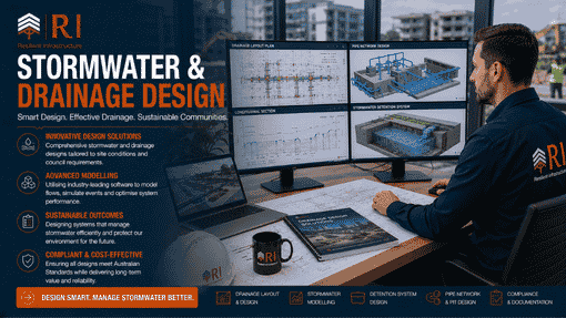
Where the project needs hydraulic modelling, we run DRAINS simulations using Illawarra rainfall data. We include the model outputs in the report. Council gets the technical evidence it needs to assess the application. Nothing is left vague or assumed.
R I Eng also covers Shellharbour City Council and Kiama Municipal Council for flood assessments. The flood planning frameworks differ slightly between these LGAs. We apply the right framework for each council.
Most flood management plans for standard residential Wollongong sites are ready within five to seven business days. Sites that need hydraulic modelling take longer. If you have a specific deadline, tell us upfront — we will give you an honest answer on whether we can meet it.
Ask About Flood Management Plans
Q: My site is not near a river or a lake. Can it still be flood-affected in Wollongong?
Yes — and this surprises a lot of people. Overland flow flooding in Wollongong does not require proximity to a river or a lake. Steep escarpment terrain channels runoff rapidly across the coastal plain. Properties well away from obvious waterways can still sit within the council’s overland flow flood planning area. Check the council mapping for your specific address before assuming you are clear.
Q: Does R I Eng prepare the stormwater plan and the flood management plan together?
Yes. For flood-affected sites, both documents are typically required. R I Eng prepares them as a coordinated civil engineering package. This saves time and keeps the two documents consistent with each other, which matters because council reviewers will check both.
Q: Do I need a flood management plan for a shed or outbuilding in Wollongong?
For habitable structures, almost always yes if the site is flood-affected. For non-habitable structures like sheds, it depends on the hazard category and the council’s DCP provisions. R I Eng will confirm what applies to your specific structure and site.
Q: What happens if my finished floor levels do not meet the flood planning level?
Council will not certify the building. Floor levels must meet or exceed the flood planning level for habitable rooms. Our flood management plan for Wollongong specifies the required levels clearly so your design team can work to the correct numbers from the start.
Talk to R I Eng About Your Wollongong Site
📞 Call R I Eng Pty Ltd: +61 0451 452 932
📧 Email: riengineering2155@gmail.com
🌐 Website: riengineering.com.au
If your Wollongong development site might be flood-affected — or if council has already flagged it — get in touch with R I Eng today. We prepare flood management plans for Wollongong City Council, Shellharbour, and Kiama using the correct Illawarra-specific data. We write reports that give the council what it needs to move forward. And we tell you upfront what the process involves and how long it will take.
No guesswork. No generic templates. Just accurate civil engineering work, done properly for your site.