
Stormwater Plan Wollongong: Why the Illawarra Is Not Like Anywhere Else in NSW
A stormwater plan for Wollongong is not a document you can prepare using Sydney data and Sydney templates. I want to be upfront about that from the start — because it is the mistake that causes more resubmissions and delays for Illawarra developments than anything else we see.
Wollongong sits between two extremes. The Illawarra Escarpment rises sharply to the west. The Pacific Ocean sits hard to the east. Between them is a narrow coastal strip with constrained drainage outlets, high-intensity rainfall, and catchments that respond fast and violently during major storms. The engineering that works in Parramatta or Blacktown does not simply transfer here. The stormwater plan for Wollongong, your project needs must reflect how this specific region actually behaves — not how a generic NSW drainage template assumes it does.
R I Eng Pty Ltd prepares stormwater plans for Wollongong City Council and across the broader Illawarra. Every design uses region-specific rainfall data and reflects Wollongong’s own DCP requirements. Nothing gets borrowed from another council’s standards.

What Wollongong City Council Requires in a Stormwater Plan
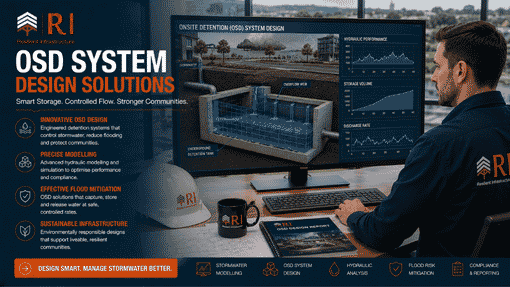
Wollongong City Council sets its stormwater requirements through its Development Control Plan 2009 and associated engineering technical specifications. A stormwater plan for Wollongong must cover several things.
One thing many engineers miss: Wollongong’s hydraulic calculations must use Illawarra-specific rainfall data from the Bureau of Meteorology. The rainfall intensities here are significantly higher than Sydney figures for equivalent storm events. Use Sydney data for a Wollongong project, and your pipe sizes will be undersized. Council will reject the plan. R I Eng uses the correct Wollongong rainfall data every time — it is not optional, it is the foundation of accurate design.

The Escarpment Suburbs: Where Stormwater Gets Complicated Fast
Suburbs like Figtree, Farmborough Heights, Cordeaux Heights, and Mount Keira sit on sloping ground at the foot of the escarpment. These sites present stormwater challenges that flat suburban sites simply do not have.
Runoff velocity is higher on steep grades. That means pipes fill faster, erosion risk is greater, and overflow paths need more careful management. A drainage design for a hillside Wollongong property needs to control velocity — not just capture volume. It also needs to ensure that drainage infrastructure does not concentrate water in ways that could destabilise the slope or push problem flows onto a downhill neighbour.
R I Eng designs stormwater plans for Wollongong escarpment sites with this in mind. We model velocity, not just volume. We design outlets that dissipate energy rather than concentrating it. And we check cross-lot drainage implications before finalising the layout — because in sloping terrain, what you do on your site directly affects every property below you.
Flood Risk and the Stormwater Plan Wollongong: What Coastal Plain Sites Need to Know
The Wollongong coastal plain — suburbs like Warrawong, Primbee, Dapto, and Albion Park Rail — sits low. Lake Illawarra, Mullet Creek, and several smaller creeks all cross this plain, and they flood regularly during significant rain events.
If your development site sits near any of these waterways, your stormwater plan needs to coordinate with Wollongong City Council’s flood planning provisions. For some sites, the stormwater plan alone is sufficient. For others, a separate flood assessment is also required — particularly where the site is within a defined flood planning area under the council’s DCP.
R I Eng handles both the stormwater civil design and flood documentation. We prepare them together, which means the two documents are consistent with each other, and there is no gap between them that the council can question. We do not prepare planning documentation or DA lodgement advice — our work is the civil and hydraulic engineering behind the designs. But we make sure that engineering is thorough, accurate, and ready for whatever technical review council applies.
Why Wollongong Stormwater Plans Need Region-Specific Engineering
Here is the short version of why Wollongong is different — and why it matters for your project.
Wollongong receives more intense rainfall than Sydney. The escarpment triggers orographic rainfall — moist air from the ocean hits the escarpment wall, rises rapidly, and dumps significant rainfall on a narrow strip of land. The coastal drainage outlets are limited. There is only so much capacity in the channels and pipes that eventually reach the ocean or Lake Illawarra.
That combination — high input, limited capacity — means stormwater plans for Wollongong must be engineered conservatively and accurately. R I Eng uses Wollongong’s actual IFD (Intensity-Frequency-Duration) rainfall data in every DRAINS model we run for this region. We do not apply Sydney figures and hope for the best. The difference matters, and council engineers reviewing your submission will notice if the rainfall data is wrong.

Ask R I Eng Most Often
Q: Does Wollongong City Council require OSD for residential developments?
Yes. OSD is a requirement for most Wollongong residential developments that increase the impervious area on a site. New roofs, new driveways, new paving — all of these trigger the requirement. R I Eng calculates the correct detention volume using Wollongong’s specific DCP parameters and DRAINS modelling. The volume will be different to what the same site would require in Sydney, because the rainfall intensity is different and the PSD parameters differ.
Q: Is the rainfall data different for Wollongong compared to Sydney?
Yes — significantly. Wollongong’s rainfall intensities are higher than Sydney’s for equivalent storm events. This affects pipe sizing, OSD volumes, and overflow design. Using Sydney rainfall data for a Wollongong project produces an underdesigned system. R I Eng always uses the correct Illawarra IFD data from the Bureau of Meteorology for every Wollongong stormwater plan we prepare.
Q: My site is near Lake Illawarra. Do I need a flood assessment as well as a stormwater plan?
Possibly yes. Sites within Wollongong’s flood planning areas typically need flood documentation alongside the stormwater civil design. R I Eng can prepare both. We assess your site, confirm what Wollongong City Council’s mapping shows for your property, and prepare whichever documents the engineering requires. We handle it as a single coordinated package.
Q: Can R I Eng prepare stormwater plans for Shellharbour and Kiama councils?
Yes. R I Eng works across the Illawarra region — Wollongong City Council, Shellharbour City Council, and Kiama Municipal Council all have their own DCP requirements, and we design for each one separately. Do not assume one council’s standards apply to another — they differ on OSD parameters, drainage connection requirements, and hydraulic modelling expectations.
Work With Engineers Who Know the Illawarra
R I Eng Pty Ltd designs stormwater plans for Wollongong and the broader Illawarra region. Our work is civil engineering — hydraulic modelling, drainage design, OSD calculations, and flood assessments. We prepare documents that Wollongong City Council’s engineering team can review and approve without chasing additional information.
If you have a site in Wollongong, Shellharbour, or Kiama and need a stormwater plan prepared properly, get in touch.
📞 Call R I Eng: +61 0451 452 932
📧 Email: riengineering2155@gmail.com
🌐 Website: riengineering.com.au
Tell us your site address and what you are building. We will tell you exactly what the engineering requires — and we will get started fast.