
Stormwater Plan Newcastle: What Hunter Region Developers Need to Know Before They Lodge
A stormwater plan for Newcastle is something most developers and homeowners only think about when the council asks for it. By then, the project timeline is already under pressure. Newcastle City Council requires proper civil drainage documentation for almost every residential and commercial development across the LGA. Getting this sorted early — with the right civil engineering team — makes a real difference to how smoothly your project moves.
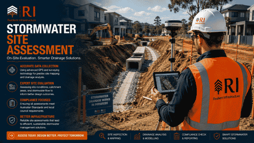
R I Eng Pty Ltd prepares stormwater plans for Newcastle and the broader Hunter region. We design accurate, practical civil drainage solutions. We do not chase DA approvals — we produce the engineering documentation your certifier and council need to assess your project.

What Does a Stormwater Plan Newcastle Actually Include?
A stormwater plan for Newcastle is a civil engineering document. It shows how rainwater moves across your site and where it goes once it leaves. Council needs to see this before it can assess your development.
A properly prepared stormwater plan covers:
- Pipe and pit layout — sizes, gradients, and positions calculated for your specific site
- Surface drainage grades — finished levels that move water toward collection points, not toward your neighbour
- OSD design — the underground detention system Newcastle Council requires when development adds a hard surface to a site
- Overflow routing — what happens during a major storm when the drainage system reaches capacity
- DRAINS hydraulic modelling — software-based proof that the system performs under Newcastle’s design storm events
- Connection to council infrastructure — the exact tie-in point to the street drainage network, designed to Newcastle City Council’s standards
Each of these elements serves a specific engineering function. Leave one out, and the council will come back asking for it.

Newcastle’s Terrain Makes Stormwater Design Site-Specific
Newcastle is not a flat, uniform city. The LGA covers dramatically different terrain, and that terrain drives the drainage design.
Coastal suburbs like Merewether, Bar Beach, and Newcastle East sit on sandy soils near the ocean. Sandy soils drain differently from clay-heavy inland sites. Proximity to the estuary also means tidal levels can interact with stormwater drainage during storm events — a factor that needs engineering consideration, not a template answer.
Hillside suburbs like Merewether Heights, Adamstown Heights, and parts of Jesmond involve steep gradients. Steep sites generate fast-moving runoff. That speed means erosion risk, scour potential at drainage outlets, and higher velocities inside pipes. The drainage design needs to account for all of this.
Flat western suburbs like Mayfield, Broadmeadow, and Waratah present a different challenge — limited natural fall means drainage relies more heavily on properly designed pipe grades and pit locations to move water effectively.
R I Eng designs stormwater plans for Newcastle that reflect the actual site. We work from your survey data, not assumptions.
Flooding in Newcastle: What It Means for Your Stormwater Plan
Newcastle has experienced serious flooding in recent years. Throsby Creek, Stoney Creek, and Ironbark Creek have all caused significant inundation across parts of the LGA. Council has responded by expanding the range of sites where flood documentation is required alongside the stormwater plan.
This does not mean every Newcastle site needs a flood report. But if your property sits near a creek, gully, or low point in the street network, there is a real chance your development triggers a flood assessment requirement. R I Eng will check the flood mapping for your site before we quote. We flag the issue upfront — not after you have already lodged.
Where flood documentation is needed, we prepare both the stormwater plan and the flood assessment together. One team, one process, no coordination gap between documents.
Which Newcastle Projects Need a Stormwater Plan?
Most of them. Here is a practical breakdown:
New homes — yes, always. New roof area means new runoff. Council requires a stormwater plan.
Granny flats and secondary dwellings — yes. Even a modest structure adds impervious area. Newcastle Council requires drainage documentation for these projects.
Duplexes and dual occupancies — yes. Two dwellings mean more roof, more driveway, more combined runoff to manage.
Townhouses and multi-unit developments — yes, and the complexity increases considerably. Shared drainage infrastructure, communal driveways, and large combined roof catchments all require careful civil design.
Commercial and industrial developments — yes. These often trigger additional requirements around stormwater quality on top of the standard drainage design.
Extensions and additions — depends on the scale. Adding a significant new roof or paved area usually triggers stormwater requirements. A purely internal renovation generally does not. If you are unsure, a quick call to our team will give you a clear answer in minutes.

How R I Eng Prepares Your Stormwater Plan Newcastle
We start with your site survey, and we check Newcastle City Council’s drainage standards and any site-specific constraints. We design the drainage layout in Auto CAD — pipes, pits, grades, OSD, overflow routing — and run the DRAINS model to confirm the system meets council’s design storm requirements.
The finished package includes engineering drawings and hydraulic calculations. Your certifier gets everything they need in one document. We do not send partial submissions and wait for questions.
Most residential stormwater plans for Newcastle projects take two to four business days from receipt of your survey. We keep you informed throughout. If you have a deadline, tell us early — we will work around it where we can.
5 Questions Newcastle Clients Ask R I Eng Most Often
Q: Does Newcastle City Council require DRAINS modelling for a stormwater plan?
For most development types, yes. Newcastle Council expects hydraulic modelling to prove the drainage design performs under design storm conditions. R I Eng prepares DRAINS models as standard for all Newcastle stormwater plans — it is part of the package, not an add-on.
Q: My site is near Throsby Creek. Do I need a flood assessment as well?
Possibly yes. If your site falls within Newcastle’s mapped flood planning area, a flood assessment is required alongside the stormwater plan. R I Eng checks the flood mapping for every Newcastle project before we start. We prepare both documents together when needed.
Q: Does R I Eng cover Lake Macquarie, Maitland, and Port Stephens?
Yes. We work across the entire Hunter region — Newcastle City Council, Lake Macquarie City Council, Maitland City Council, Port Stephens Council, and Cessnock City Council. Same team, same standards, same turnaround times.
Q: How long does a stormwater plan for Newcastle take to prepare?
Most residential projects take two to four business days from receipt of survey data. Larger or more complex sites take longer. We give you a clear timeline when we quote — not a vague estimate.
Q: Can R I Eng prepare stormwater plans for commercial projects in Newcastle?
Yes. We work on residential, commercial, and industrial developments across the Newcastle LGA and Hunter region. Commercial projects often involve additional requirements — stormwater quality measures, larger OSD volumes, and more detailed hydraulic modelling — and we handle all of it.

Work With a Civil Engineering Team That Knows the Hunter Region
R I Eng Pty Ltd has delivered civil drainage designs across Newcastle and the Hunter for over 12 years. We know the terrain, the council standards, and the specific challenges that come with designing drainage in this part of NSW.
We produce the engineering documentation. You get designs that work on your site, in the real Newcastle environment — not drawings copied from a project somewhere else.
📞 Call R I Eng Pty Ltd: +61 0451 452 932
📧 Email: riengineering2155@gmail.com
🌐 Website: riengineering.com.au
Tell us your site address and what you are building. We will take it from there.